Uranium Exploration Intensifies: Belmont Resources Deploys Advanced Gravity Survey at Crackingstone Project
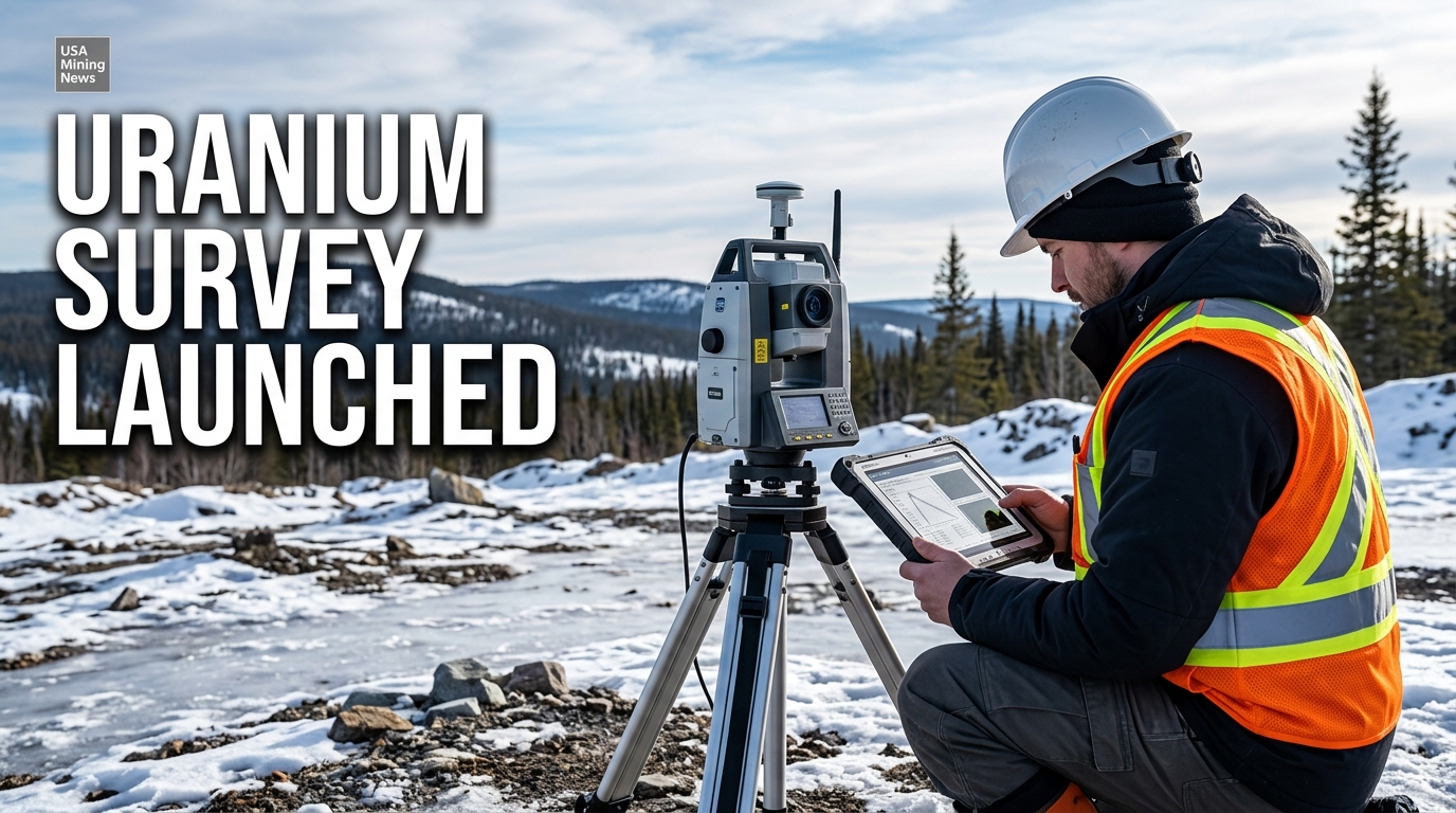
Vancouver, British Columbia – October 7, 2026 – Belmont Resources Inc. (TSX-V: BEA; FSE: L3L2) has announced the commencement of a high-resolution ground gravity survey at its wholly owned Crackingstone Uranium Project, situated approximately six kilometers from Uranium City in Saskatchewan, Canada. This strategic deployment of advanced geophysical techniques marks a critical step forward in the company's methodical approach to identifying and delineating potential uranium mineralization within the highly prospective Athabasca Basin region, a globally significant hub for high-grade uranium deposits.
The launch of this gravity survey underscores Belmont’s commitment to leveraging modern exploration methodologies to enhance its understanding of the Crackingstone property's subsurface geology. In an industry increasingly focused on efficiency and de-risking exploration capital, the integration of detailed geophysical data is paramount for optimizing subsequent drilling campaigns and maximizing the chances of discovery.
The Strategic Importance of Gravity Surveys in Uranium Exploration
Gravity surveys are a fundamental geophysical tool widely employed in the mining sector, particularly in the nuanced field of uranium exploration. These surveys measure minute variations in the Earth's gravitational field, which are directly related to differences in the density of subsurface rocks and geological structures. In the context of uranium, these density variations can be critical indicators of favorable geological environments.
Specifically, gravity surveys aid uranium exploration by identifying key geological features such as faults, alteration zones, and intrusive bodies. Faults often serve as conduits for mineralizing fluids, creating pathways for uranium deposition. Alteration zones, characterized by chemical changes in rocks due to hydrothermal activity, can be associated with the concentration of uranium. Intrusive bodies, depending on their composition and interaction with host rocks, can also play a role in concentrating uranium mineralization. Detecting these features through density contrasts allows geologists to infer the presence of structures that could host uranium deposits, even when buried beneath significant overburden.
The precision and resolution of a gravity survey are directly proportional to the density of its data points. Belmont's decision to deploy closely spaced gravity stations at 50-meter by 50-meter intervals across designated areas of the Crackingstone property indicates a deliberate strategy for high-resolution data acquisition. With approximately 2,500 stations planned for the survey, the resulting dataset is expected to provide a detailed subsurface density model, significantly improving the geological understanding of the project area. This level of detail is crucial for distinguishing subtle but economically significant density anomalies that might correlate with uranium mineralization.
Belmont's Integrated Exploration Strategy at Crackingstone
Belmont Resources’ current strategy at Crackingstone centers on a multi-faceted approach, integrating modern geophysical data with results from earlier exploration efforts. The newly acquired gravity data will not be analyzed in isolation but will be combined with a comprehensive array of existing datasets to construct a more robust and comprehensive geological model. This synergistic approach is designed to provide a holistic view of the subsurface, allowing for more informed decision-making regarding drill targeting.
The integration process will involve comparing the gravity findings with several crucial geological and geophysical indicators:
- Uranium Radiometric Anomalies: Surface or airborne radiometric surveys detect gamma radiation emitted by naturally occurring radioactive isotopes, including uranium. Positive gravity anomalies or specific density patterns coinciding with radiometric highs can indicate areas of potential uranium concentration.
- Uranium-to-Potassium (U-to-K) and Uranium-to-Thorium (U-to-Th) Responses: Ratios derived from radiometric data can help differentiate between various types of uranium mineralization and background radiation, providing further context for gravity anomalies.
- Electromagnetic (EM) Conductors: EM surveys detect variations in electrical conductivity in the subsurface. Uranium deposits, particularly those of the unconformity-related type found in the Athabasca Basin, are often associated with graphitic basement conductors, making the correlation of gravity data with EM conductors a powerful targeting tool.
- Interpreted Faults and Structural Corridors: As mentioned, faults are critical controls on uranium mineralization. Gravity data can help delineate these structures, especially those that might be otherwise obscured.
- Geological Contacts: The boundaries between different rock types, particularly those between basement rocks and overlying sedimentary sequences, are often preferential sites for uranium deposition.
- Pelitic Units: These fine-grained sedimentary rocks, rich in clay minerals, often contain elevated levels of organic matter and can act as reductants, precipitating uranium from hydrothermal fluids. Identifying their distribution can highlight favorable trap sites.
- Historical Uranium Occurrences and Workings: The Crackingstone area has a documented history of uranium exploration and mining. Modern data integration can help reinterpret and extend the potential of these historical sites.
- Existing Priority Targets: The new data will be used to validate and refine previously identified exploration targets, ensuring that the upcoming drilling is focused on the most promising zones.
This meticulous integration exercise is intended to determine whether the diverse datasets indicate common features potentially favorable for uranium-bearing structures and trap sites. By layering these different geophysical and geological perspectives, Belmont aims to reduce exploration risk and increase the probability of encountering significant uranium mineralization during the subsequent drilling phase.
Crackingstone Project: Location and Historical Context
The Crackingstone Uranium Project’s location approximately six kilometers from Uranium City, Saskatchewan, places it within a region historically renowned for its uranium endowment. Uranium City itself was established in the 1950s as a mining community to support the numerous uranium operations in the Beaverlodge area of northern Saskatchewan. While many of these operations ceased production in the 1980s, the geological potential of the region remains high, particularly given advancements in exploration technology and a renewed global interest in uranium.
Saskatchewan is globally recognized as a premier jurisdiction for high-grade uranium deposits, primarily hosting unconformity-related deposits within the Athabasca Basin. Although the Crackingstone project is located on the rim of the Athabasca Basin, the presence of historical occurrences and the geological setting indicate a potential for vein-type or other basement-hosted mineralization styles that could be significant. Belmont’s strategy acknowledges this geological heritage, seeking to apply modern understanding to an area with known uranium prospectivity.
Leadership and Technical Expertise Driving the Program
The methodical advancement of the Crackingstone project is guided by an experienced leadership team and technical advisors. George Sookochoff, Chairman of Belmont Resources, articulated the significance of the ongoing work, stating, "The commencement of the gravity survey marks an important step forward in our Crackingstone exploration programme. We now have multiple exploration datasets that are being brought together to improve our understanding of the property and, most importantly, to help us focus our drilling on the strongest targets." This statement underscores the strategic intent behind the integrated approach and the company’s focus on optimizing drilling efficiency.
Overseeing the technical evaluations for the project is Senior Geological Advisor Ken Wheatley, whose expertise is invaluable in navigating the complexities of uranium exploration. The involvement of seasoned professionals like Mr. Wheatley ensures that the data acquisition, interpretation, and target generation are executed to industry best practices, adding confidence to the project's technical foundation.
Advancing Towards Drilling: Future Outlook and Permitting
The gravity survey is an integral component of Belmont's broader exploration program, which is purposefully advancing towards a planned diamond drilling campaign. The company anticipates a drilling program of approximately 2,000 meters at Crackingstone, a significant undertaking that will physically test the targets refined through the ongoing geophysical and geological integration.
A crucial factor enabling this progression is Belmont’s proactive securing of regulatory approvals. The company holds a Crown Land Work Authorisation for up to 40 drill-holes, which is valid until November 30, 2028. This long-term authorization provides Belmont with considerable flexibility and certainty to execute its drilling plans without immediate permitting constraints, a significant advantage in resource-rich but highly regulated jurisdictions like Saskatchewan. Such authorizations are critical in the mining industry, as they represent a green light from regulatory bodies, indicating that the company’s proposed exploration activities meet environmental and land-use standards.
Broader Implications for the Uranium Market and Mining Industry
Belmont Resources' systematic exploration at Crackingstone contributes to the broader narrative of renewed interest and investment in the uranium sector. With global demand for clean energy on the rise and nuclear power gaining increasing acceptance as a critical component of decarbonization strategies, the security and diversity of uranium supply chains are paramount. Projects like Crackingstone, even in their early exploration phases, play a role in identifying future sources of this vital energy metal.
The success of exploration efforts in established uranium districts, particularly those in politically stable jurisdictions such as Canada, is watched closely by industry professionals and investors. New discoveries or the successful re-evaluation of historical prospects can contribute to long-term supply stability and influence future market dynamics. Belmont’s methodical application of advanced geophysical techniques reflects a modern, risk-mitigating approach to exploration that is becoming increasingly standard across the industry. This strategy aims to ensure that capital is deployed effectively, maximizing the potential for significant discoveries in an era of heightened commodity price volatility and supply chain scrutiny.
Conclusion
The launch of the high-resolution ground gravity survey at Belmont Resources' Crackingstone Uranium Project represents a significant milestone in the company’s exploration endeavors. By meticulously gathering and integrating diverse geophysical and geological datasets, Belmont is strategically positioning itself to identify and prioritize the most prospective drill targets for its upcoming 2,000-meter diamond drilling campaign. Supported by strong technical leadership and robust permitting, this systematic approach to exploration in a historically rich uranium district could prove pivotal for Belmont Resources and contribute to the ongoing efforts to secure future uranium supply for the global clean energy transition.