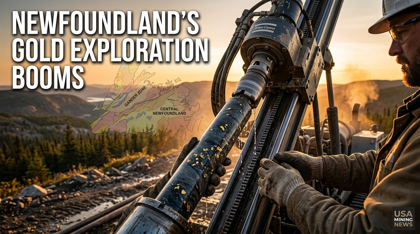
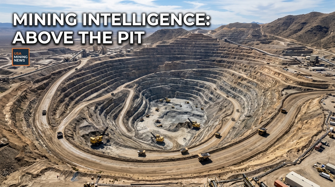
The mining sector, a pillar of global industrial supply chains, is continuously seeking innovative solutions to enhance operational efficiency, ensure safety, and meet stringent environmental regulations. In this evolving landscape, the role of advanced technologies has become paramount. A significant commentary published on June 4, 2026, by Sean Donegan, President and CEO of US-based Satelytics, underscored a fundamental shift in mining intelligence: its future, he asserts, begins “above the pit.” Donegan’s perspective highlights the transformative power of geospatial analytics in monitoring and managing complex mining operations, marking a new era for industry oversight.
The Dawn of Geospatial Intelligence in Mining
Geospatial analytics, at its core, involves the collection, processing, and analysis of data associated with a specific geographic location. In the context of mining, this encompasses a wide array of information derived from sources such as satellites, aerial imagery, and drones. Donegan’s insights emphasize how this technological frontier is not merely an incremental improvement but a paradigm shift in how miners detect critical operational parameters. By leveraging high-resolution imagery and sophisticated analytical algorithms, companies can gain an unprecedented bird's-eye view, translating raw data into actionable intelligence.
Historically, monitoring large-scale mining operations has been a labor-intensive and often hazardous endeavor, involving extensive ground surveys and manual inspections. While these methods remain essential in specific contexts, they are inherently limited by frequency, scope, and the time required to collect and interpret data. Geospatial analytics offers a compelling alternative, providing frequent, broad-area coverage with remarkable precision. This shift is particularly relevant for the US mining industry, which operates under some of the world's most rigorous environmental and safety standards, demanding continuous and verifiable compliance.
Key Applications: Revolutionizing Risk Detection
The commentary from Satelytics' CEO specifically identified three critical areas where geospatial analytics is transforming mining operations: detecting land movement, identifying environmental risks, and monitoring for unauthorized activity. These applications address some of the most pressing challenges faced by mining companies globally, offering proactive solutions that enhance safety, reduce environmental impact, and protect assets.
Land Movement Detection: Mitigating Catastrophic Failures
One of the most significant risks in mining operations, particularly in open-pit mines and around tailings storage facilities (TSFs), is land movement. Unstable slopes, pit wall failures, and tailings dam integrity issues can lead to catastrophic events, endangering lives, causing extensive environmental damage, and incurring massive financial losses. Traditional monitoring techniques, such as ground-based inclinometers, extensometers, and total station surveys, provide localized data but can miss broader patterns of deformation across vast areas.
Geospatial analytics, utilizing interferometric synthetic aperture radar (InSAR) derived from satellite data or advanced photogrammetry from drones, can detect minute shifts in land surface elevation and lateral movement over large geographical expanses. These systems can map deformation fields with millimeter-level precision, identifying areas of subsidence, heave, or shearing across an entire mine site. The data, often presented as a model of mine elevation using aerial pictures from a drone, enables engineers to identify early warning signs of instability. This proactive intelligence allows for timely intervention, such as adjusting excavation plans, reinforcing unstable areas, or implementing emergency protocols, thereby significantly reducing the risk of slope failures or TSF breaches. This capability is paramount for maintaining the structural integrity of mine infrastructure and, most importantly, ensuring the safety of personnel and surrounding communities.
Environmental Risk Monitoring: Enhancing Stewardship and Compliance
Mining’s environmental footprint is a major concern for regulators, communities, and investors. Managing environmental risks, such as water contamination, air quality degradation from dust, and land disturbance, is central to sustainable mining practices. Geospatial analytics provides an invaluable toolkit for comprehensive environmental monitoring, moving beyond intermittent sampling to continuous, wide-area surveillance.
- Water Quality: Satellite-borne chemical sensors and drone-mounted hyperspectral cameras can analyze water bodies for indicators of contamination, such as changes in pH, turbidity, or the presence of specific minerals and heavy metals. This allows for early detection of potential leaks from tailings ponds, process water circuits, or acid mine drainage, enabling rapid response and containment efforts.
- Air Quality: Monitoring dust plumes emanating from haul roads, crushing operations, and waste dumps is crucial for local air quality management. Geospatial platforms can track dust dispersion patterns, quantify particulate matter concentrations, and identify specific sources, helping mines optimize dust suppression strategies and ensure compliance with air quality regulations.
- Vegetation Health and Reclamation: Post-mining land reclamation is a regulatory requirement and a key component of a mine's social license to operate. Geospatial tools can assess vegetation health and growth rates across reclaimed areas, utilizing spectral indices to gauge the success of rehabilitation efforts. This data helps mine operators track progress, identify struggling areas, and make informed decisions on replanting or soil amendment strategies.
- Spill Detection: The ability to quickly detect spills of fuels, lubricants, or process chemicals is critical. Infrared sensors can identify temperature anomalies associated with spills, while spectral analysis can pinpoint specific chemical signatures, enabling rapid clean-up and minimizing environmental damage.
By offering a continuous and comprehensive view of environmental parameters, geospatial analytics empowers mining companies to exceed compliance requirements, demonstrate stronger environmental stewardship, and build greater trust with stakeholders.
Unauthorized Activity: Securing Operations and Assets
Mine sites are often remote, extensive, and contain valuable assets, making them vulnerable to unauthorized access, theft, and illegal mining activities. Traditional security measures, such as perimeter fencing, CCTV, and ground patrols, can be resource-intensive and may not cover the entirety of large mining concessions effectively.
Geospatial analytics provides an elevated solution for site security and operational integrity. High-resolution satellite imagery and drone surveillance can regularly scan vast areas for anomalies that might indicate unauthorized activity. This includes detecting new tracks or roads in restricted areas, identifying makeshift structures, or observing patterns of human movement outside designated zones. Furthermore, it aids in monitoring inventory levels in stockpiles, ensuring accurate reconciliation and deterring theft. For companies operating in regions susceptible to illegal mining, this technology offers a critical tool for identifying and combating such activities, thereby protecting their concessions and preventing associated environmental and social harms. The ability to monitor from "above the pit" provides a strategic advantage, offering a broad, unhindered view that ground-level security often cannot achieve.
Market and Industry Context: Why This Matters
The integration of geospatial analytics into mining operations is not merely a technological 'nice-to-have'; it represents a strategic imperative. The global mining industry faces increasing pressure from various fronts:
- Regulatory Scrutiny: Governments worldwide are imposing stricter environmental and safety regulations, demanding greater transparency and accountability from mining companies. Geospatial data provides verifiable evidence of compliance, aiding in permitting and reporting processes.
- ESG Demands: Environmental, Social, and Governance (ESG) factors are central to investment decisions and public perception. Demonstrating effective environmental management and robust safety protocols through objective, data-driven monitoring is crucial for attracting capital and maintaining a social license to operate.
- Operational Efficiency: Mining is a capital-intensive industry. Any technology that can optimize resource allocation, reduce operational risks, and prevent costly disruptions contributes directly to the bottom line. Reducing the need for frequent, labor-intensive ground surveys, for instance, translates into significant cost savings and improved safety for personnel.
- Safety Enhancement: By proactively identifying geotechnical and environmental risks, geospatial analytics directly contributes to a safer working environment for miners and safer conditions for nearby communities.
Companies like Satelytics, a US-based entity, are at the forefront of this revolution, developing and deploying sophisticated platforms that turn raw satellite and aerial data into actionable intelligence. Their work aligns with the broader industry trend of digitalization and automation, moving towards smarter, more resilient mining operations.
Future Outlook: Intelligent Mines and Predictive Analytics
The vision articulated by Sean Donegan of Satelytics points towards a future where mining intelligence is primarily derived from above. This future involves not just remote sensing but the seamless integration of geospatial data with other digital technologies, including artificial intelligence (AI), machine learning (ML), and the Internet of Things (IoT).
AI and ML algorithms are rapidly enhancing the capabilities of geospatial analytics, allowing for automated detection of subtle patterns, prediction of potential failures, and optimization of operational responses. As more data is collected over time, these systems become increasingly sophisticated, moving from reactive monitoring to proactive, predictive analytics. Imagine a system that can not only detect early signs of land movement but also predict the likelihood and timing of a slope failure based on historical data, weather patterns, and operational changes.
Furthermore, the confluence of geospatial data with real-time sensor data from ground-based IoT devices within mines will create a comprehensive "digital twin" of the entire operation. This integrated platform will provide an unparalleled level of situational awareness, enabling mining executives and engineers to make more informed, timely, and precise decisions. The ongoing advancements in satellite technology, drone capabilities, and data processing power will continue to expand the scope and accuracy of what can be monitored from afar.
The commentary from June 4, 2026, serves as a powerful reminder that the future of mining is inextricably linked with technological innovation. Geospatial analytics, by offering a superior vantage point and analytical depth, is poised to redefine standards for safety, environmental performance, and operational efficiency across the global mining industry, solidifying the role of aerial intelligence as a foundational element of modern mine management.